
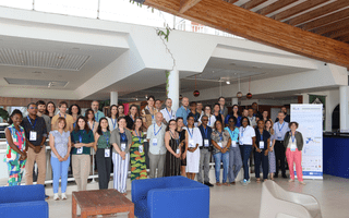
Second SystR consortium meeting in Guadeloupe
In December 2025, the SystR partnership met in Guadeloupe for its second consortium meeting.
Key Numbers
514 000
inhabitants in 33 municipalities
Up to 7°C higher
nighttime temperatures in central Strasbourg than in nearby rural areas
Created in 1967 as the Strasbourg Urban Community, it became a metropolis in 2015, forming a hub of inter-municipal cooperation that promotes shared development while preserving local autonomy.
Geographically, the territory lies between the Vosges Mountains and the Black Forest, within the Rhine Graben valley. Its flat, low-lying landscape is crossed by the Rhine and the Ill rivers, as well as the Bruche and the Zorn, creating a dense hydrographic network that supports agriculture, transport, and biodiversity. The region experiences a semi-continental climate, with increasingly warm summers and milder winters due to climate change.
The Eurometropolis combines a dense urban core with peri-urban and rural surroundings. Strasbourg’s historic center, the Grande Île (a UNESCO World Heritage site), anchors a vibrant metropolitan area served by an extensive tram, bus, and cycling network, as well as regional and high-speed rail links. Beyond the city, agricultural and natural landscapes contribute to ecological balance, local food systems, and recreation.
Economically, the EMS hosts a diversified and knowledge-driven economy. It is home to major European institutions - the European Parliament, Council of Europe, and European Court of Human Rights - making governance, law and diplomacy key employment sectors. The public sector is also a major employer in Strasbourg, with the Eurometropolis administration alone accounting for around 7,000 staff members, in addition to those employed by the departmental and regional administrations. The University of Strasbourg and leading research centers drive innovation in biotechnology, chemistry, medicine, and digital technologies. Industry and logistics are concentrated around the Port of Strasbourg - one of Europe’s largest inland ports - and business zones such as the Espace Européen de l’Entreprise and the Plaine des Bouchers. Commerce, services, and creative industries further enrich the metropolitan economy, supported by a multilingual and cross-border environment.
As part of the Strasbourg-Ortenau Eurodistrict, a cross-border urban area of over one million people, the Eurometropolis plays a leading role in European cooperation. Its ambition is to strengthen its international influence and promote sustainable, inclusive growth for the region.
Fourteen of the 33 municipalities are exposed to floods and mudslides, putting over 14,000 homes and 4,000 businesses at risk. The Ill and Bruche rivers frequently overflow, with historic floods recorded in 1882, 1919, and 1990. Urbanisation and impermeable surfaces amplify runoff, while climate change is expected to increase the frequency and intensity of extreme rainfall events. Western communes, where the terrain is more uneven, are particularly prone to flash floods and debris flows that disrupt transport and local services.
Heatwaves and rising temperatures pose another major risk, making summers increasingly difficult to endure. Average summer temperatures are projected to rise by about +2.3°C by 2050, with around nine more heatwave days per year compared to the late 20th century. In recent years, temperatures reached record highs of 38-39°C, while nighttime temperatures in central Strasbourg can be up to 7°C higher than in surrounding rural areas. 67% of the Eurometropolitan population is affected by an urban heat island of intensity 4 during a summer heatwave. These conditions pose serious health risks - especially for elderly residents, children and people with pre-existing conditions - while straining energy systems and damaging transport infrastructure.
Droughts and water stress are also becoming more frequent. Low water levels in the Rhine, as seen in 2022, hinder river navigation and freight transport, while prolonged dry periods affect agriculture, green spaces, and biodiversity.
Furthermore, rising temperatures have favoured the spread of invasive species, notably the tiger mosquito (Aedes albopictus), now established across all communes. This vector of diseases, such as dengue and chikungunya, led to the first locally transmitted cases in 2025, underscoring new public health concerns.
This platform will provide technical and strategic support to municipalities in planning and implementing adaptation measures.
Building on previous assessments by I4CE, the Eurometropolis is also developing a financial roadmap for adaptation to a +4°C climate scenario. This roadmap will identify funding needs, mobilise private investment, and reinforce cooperation between local, regional, and national stakeholders. It builds on the Local Resilience Taskforce, established under the CLIMATEFIT project, to connect financial actors with on-the-ground adaptation initiatives.
The roadmap will further integrate the economic impacts of low water levels on freight transport along the Rhine, notably for the Port of Strasbourg and in collaboration with the neighbouring city of Kehl in Germany, offering new opportunities for cross-border resilience planning.
ADEME and Cerema (the French centre for studies and expertise on risks, the environment, mobility and planning) will update and test the Trajectoires d'Adaptation au Changement Climatique des Territoires (TACCT) tool, applying the PR1.2 guidelines to make decision-support tools more systemic and replicable across the Strasbourg territory.
Apart from this, Eurometropolis of Strasbourg, with the help of the Climate Agency, will structure a network on climate adaptation with external partners (economic and financial actors, associations, consular chambers, the tourism office, the health sector, risk-management stakeholders, etc.) in order to broaden exchanges on these topics, collectively develop the new Climate Plan, support the appropriation of the adaptation strategy, and improve coordination between stakeholders in the event of a crisis. It will also ensure coordination with the Resilience Task Force, which is working on financing issues and capacity-building as part of the CLIMATEFIT project.
Because adaptation in the agricultural sector - aside from dealing with muddy water runoff - receives less attention than issues like urban heat or flooding, the project will draw inspiration from the example of Banská Bystrica in Slovakia to strengthen agricultural resilience and implement practical measures such as crop adaptation. These solutions could also be shared within the Territorial Food Plan, a strategy that aims to promote local market gardening to better meet local food production needs.

In December 2025, the SystR partnership met in Guadeloupe for its second consortium meeting.
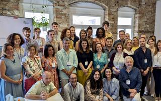
In June of 2025, the entire SystR partnership met for the first time to launch four years of work on systemic resilience.