New SystR booklet supports regions in building collaborative climate adaptation
SystR has published a new Regional Adaptation Board Booklet, providing practical guidance for local and regional authorities, practitioners, and stakehol...

Key Numbers
~ 66 000
Inhabitants
10 200
residents per km²


SystR has published a new Regional Adaptation Board Booklet, providing practical guidance for local and regional authorities, practitioners, and stakehol...
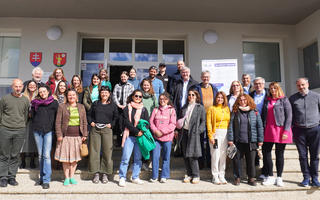
In April 2026, partners from across Europe came together in the Slovak village of Ábelová for the third consortium meeting of the SystR project.
#Guidelines, #Project Deliverable
The Regional Adaptation Board (RAB) Booklet is developed as a roadmap to establishing a Regional Adaptation Board - and related Climate Innovation Hub (...