Guadeloupe, France

The French archipelago tests coastal solutions and restores mangrove ecosystems to limit the effects of climate-related hazards.
Phot of an island

Image from Dreamstime by Iryna Shpulak licensed under ICLEI Europe's Dreamtime License

Key Numbers

383 000

People live on the islands

5

Municipalities make up the demonstration area

50m

of shoreline erosion in some parts of the islands

The two main islands, Grande-Terre and Basse-Terre, offer a striking contrast: Grande-Terre’s low limestone plateaus and lively coastlines complement Basse-Terre’s rugged volcanic peaks, crowned by the active Soufrière volcano.

Historically, Guadeloupe was colonized by France in 1635 and developed as a plantation economy. Slavery, which structured society and agriculture for over two centuries, was abolished in 1848, when nearly 87,000 enslaved people were emancipated. Since 1946, Guadeloupe has been an overseas department of France and is now also recognized as an outermost region of the European Union. 

Today, Guadeloupe’s economy is driven mainly by the service sector and public administration, with agriculture (notably bananas, sugarcane, and rum) and fishing remaining important local activities. Tourism is a major source of income, attracting visitors to its beaches, coral reefs, and natural wonders. However, the region remains highly dependent on imports of food, fuel, and construction materials, making it vulnerable to external shocks.

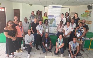
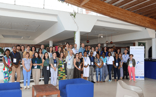
Our demonstration site is located in Grande-Terre, within the Communauté d’Agglomération du Nord Grande-Terre (CANGT), an inter-municipal area of five coastal and rural municipalities with about 57,000 inhabitants (around 15% of Guadeloupe’s population). The CANGT combines urban centers, rural areas, and coastal zones, with activities including agriculture, fishing, tourism, and local industries linked to the wider economy. This diversity of environments and livelihoods, coupled with its coastal exposure, makes it a valuable site for exploring systemic vulnerabilities and adaptation strategies in small island contexts.

Tropical cyclones and hurricanes are the most destructive events. Since 1900, the archipelago has been hit by over a dozen major hurricanes, including Hurricane Maria (2017), which brought torrential rain, winds over 200 km/h, severe flooding, widespread infrastructure damages and power outages.

Heavy rainfall and flash floods are becoming more frequent, especially during the wet season (June–November). Steep mountain catchments in Basse-Terre and low-lying coastal zones in the CANGT area are particularly vulnerable, as intense rains can quickly overwhelm drainage systems and damage infrastructure, housing, and crops.

At the same time, coastal erosion and marine submersion are accelerating. With more buildings and roads concentrated along the coast than ever before, rising sea levels and stronger storms are taking a toll. In Sainte-Anne, for example, the shoreline has retreated by more than 50 meters in recent decades, while natural barriers like mangroves and reefs have been degraded, reducing coastal protection.

Droughts are also increasing in frequency and intensity, with rainfall deficits of up to 30% observed in recent years. Water shortages affect households, agriculture, and ecosystems, while faults in the water distribution infrastructure worsen the problem.

Finally, heatwaves are becoming more common and severe, impacting human health, energy demand, and outdoor work. The year 2023 ranked among the hottest on record, underscoring the region’s trend toward longer and more intense hot periods.

A key action is the restoration of mangrove ecosystems, which naturally reduce wave energy, trap sediments, and protect coastlines from erosion and flooding. The project will identify areas where mangroves once thrived, analyse the causes of their decline, and promote both natural regeneration and active replanting. Using numerical models, researchers will evaluate how restored mangroves can enhance long-term coastal protection.

Beyond that, the project will test additional coastal solutions in Le Moule and Port-Louis, two municipalities facing severe shoreline retreat. These pilots will explore innovative ways to reduce erosion and adapt to projected coastline changes over the next 30 to 100 years.

Other activities will promote climate-smart farming, eco-tourism, and better water management, helping balance food security, biodiversity conservation, and economic growth. A network of marine and meteorological sensors will also be established to improve early warning systems for coastal hazards.

Led by ADEME with local partners including CANGT, BRGM, and the Chamber of Commerce and Industry, the Guadeloupe site contributes to regional and international collaboration, sharing knowledge with other demonstration regions in Europe and the Caribbean to build a climate-resilient island territory.

Connected Partners

A visual sazing CCI Iles de Guadeloupe
Ademe Logo
CANGT logo
BRGM logo

Timeline

D1.1 Regional Reports

#Project Deliverable, #Report

This file is currently being reviewed by the European Commission.

This document provides the foundational territorial knowledge base that underpins the an...

Read more

SystR consortium in Guadeloupe

In December 2025, the SystR partnership met in Guadeloupe for its second consortium meeting.

See more on LinkedIn

Pauline Guérécheau-Desvignes, representing Guadeloupe speaks in a Session during EURESFO 2026

During EURESFO 2025, Guadeloupe representatives joined a session showcasing best practices from EU outermost territories and exploring how regional actors and European initiatives can support one another.

See more on LinkedIn